

")
Greetings and welcome to the Brunswick County weather update for Wednesday, January 7, 2026.
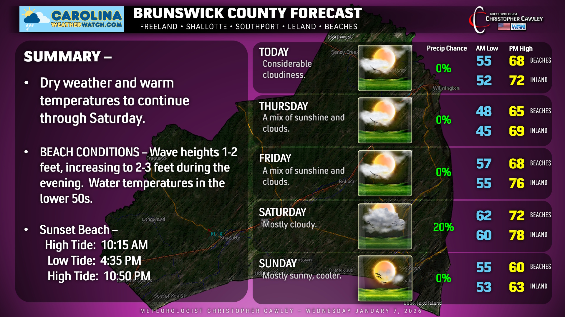
Quiet… and unseasonably warm… conditions will continue across the county through Saturday. A backdoor cold front (called “backdoor” because it drops down from the north/east instead of sweeping from west-to-east) will sink southward over the area late tonight. This won’t really bring much “sensible weather” with it… we’ll have a wind shift and our temperatures Wednesday night and Thursday will be a tick or two cooler than today.
Then the front lifts back to the north as a warm front, allowing a robust flow of warm and rather humid air to push in for Friday, Friday night, and Saturday. Depending on how much sunshine we get, high temperatures may flirt with the 80-degree mark for the farther inland locations along the Columbus County line. On the whole, we’ll see more cloudiness than sunshine through the period.
Cold front blows across the area Saturday night. There is a bit of variance in the modeling as for the frontal passage, but I believe it’ll come after supper… probably during the evening hours. The deeper, cold trough won’t pinwheel through until later Sunday, though, so while we’ll be cooler on Sunday, the real colder air (actually “seasonable” air) moves in on Monday.
From there, modeling suggests we’re dry through much of next week with seasonable to slightly above-normal temps.
BEACH CONDITIONS: Wave patterns will be from the southwest to northeast throughout the day, averaging 1-2 feet but possibly increasing to 2-3 feet during the evening hours. The water is cold… temps solidly in the lower 50s. No other beach hazard forecasts are available until the springtime.
Here’s your official forecast for Brunswick County, North Carolina!
–Meteorologist Christopher Cawley
www.CarolinaWeatherWatch.com

Be the first to comment