

")
Greetings, folks, welcome to the Brunswick County Weather Update for Sunday, January 11, 2026.
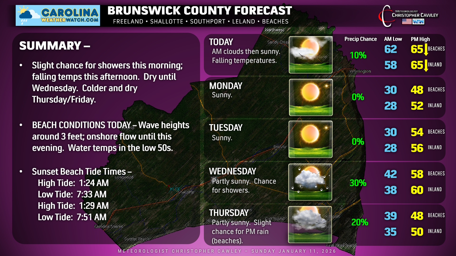
Breezy conditions will occur today in the wake of the cold front that has moved across the area. We’ll start off with some clouds and perhaps a spotty rain shower along the coast, but the sunshine will be increasing throughout the day. Temperatures will be falling, though; our highs will occur during the mid-morning hours but by the time we sit down to supper, it’ll be around 50 degrees.
Tonight will be clear and COLD with inland lows dropping into the upper 20s, around 30 at the beaches. Despite full sunshine our highs on Monday will only be in the upper 40s (beaches) to around 50 inland. Brrr.
Brrr again Monday night into early Tuesday as inland areas drop back into the 20s.
The next weather system arrives by Wednesday. Medium range model ENSEMBLES show deep troughing and perhaps a “cut off low” developing in the lower Appalachians by Thursday. (A cut off low is one that is, well, “cut off” from the typical progressive weather pattern.)
Unfortunately, any significant moisture will be displaced offshore. Some showers are possible with a frontal passage on Wednesday, but that’s about it. There may be some rain showers along the beaches Thursday afternoon as a little wave of low pressure tries to form on the front. I don’t think it’ll be anything exciting, though.
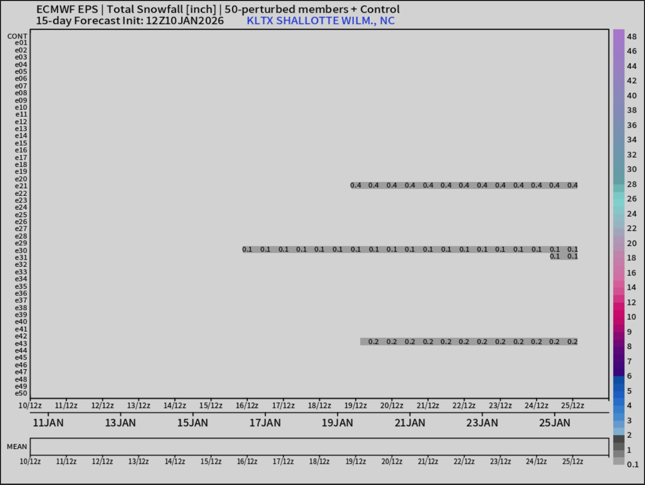
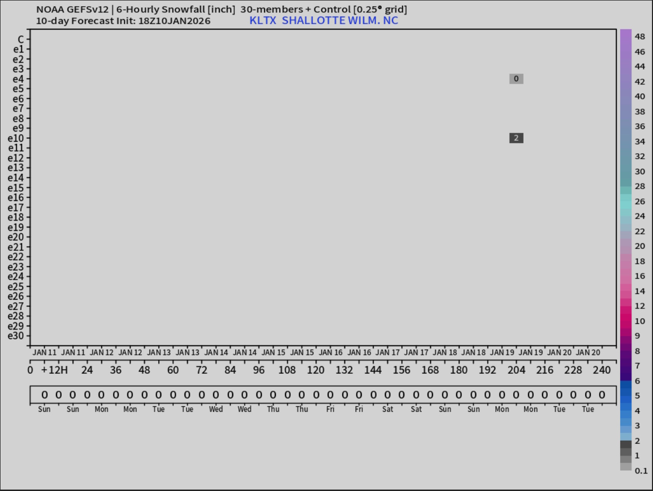
Now, I’m VERY AWARE that many people are seeing folks on social media talking about snow later in the week. Again, I look at model ensembles to get a better idea of the “big picture,” and, well, it ain’t looking too good if you’re rooting for snow. Not this week anyway.
That’ll do it for today’s report. As always, thank you for reading and have a great day!
–Meteorologist Christopher Cawley
www.CarolinaWeatherWatch.com

Be the first to comment