

")
Greetings and welcome to the Sunday edition of the Horry County Weather Update!
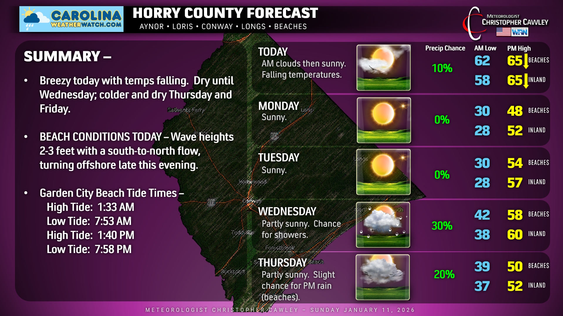
A cold front has crossed the area early this morning, and while we have some cloudiness around early, the sunshine will dominate from lunchtime onward. It’ll be breezy, and we’ll have falling temps this afternoon into the lower 50s by suppertime.
Temperatures nosedive after sunset tonight, and by the time we wake up Monday morning, inland areas will be in the upper 20s, while beaches will be around 30. Despite full sunshine on Monday, our highs will only reach the upper 40s to lower 50s. Another cold night Monday night with temps back into the 20s inland… but slightly milder Tuesday afternoon (actually around seasonal normal values).
The next weather system arrives by Wednesday. Medium range model ENSEMBLES show deep troughing and perhaps a “cut off low” developing in the lower Appalachians by Thursday. (A cut off low is one that is, well, “cut off” from the typical progressive weather pattern.)
Unfortunately, any significant moisture will be displaced offshore. Some showers are possible with a frontal passage on Wednesday, but that’s about it. Some of the modeling wants to spin up a little surface low on the front on Thursday, I’m going to put in 20% chance for showers Thursday afternoon at the beaches, but I don’t think we’ll see anything exciting.
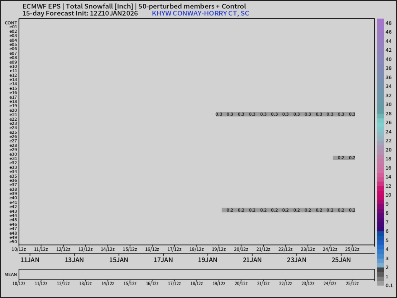
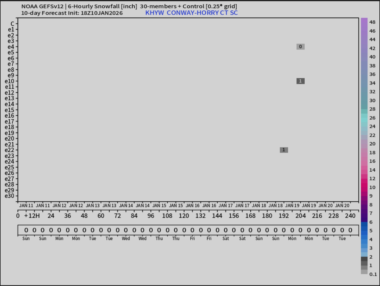
Now, I’m VERY AWARE that many people are seeing folks on social media talking about snow later in the week. Again, I look at model ensembles to get a better idea of the “big picture,” and, well, it ain’t looking too good if you’re rooting for snow. Not this week anyway.
Ok, friends, that will do it for today’s report. Here’s your Horry County area forecast, and thanks for reading!
–Meteorologist Christopher Cawley
www.CarolinaWeatherWatch.com

Be the first to comment