

")
Welcome to the Horry County Weather Update for Wednesday January 14, 2026!
If you like very cold January weather, I have some good news for you!
If you like a winter wonderland of snow, I have some not-so-good news for you.
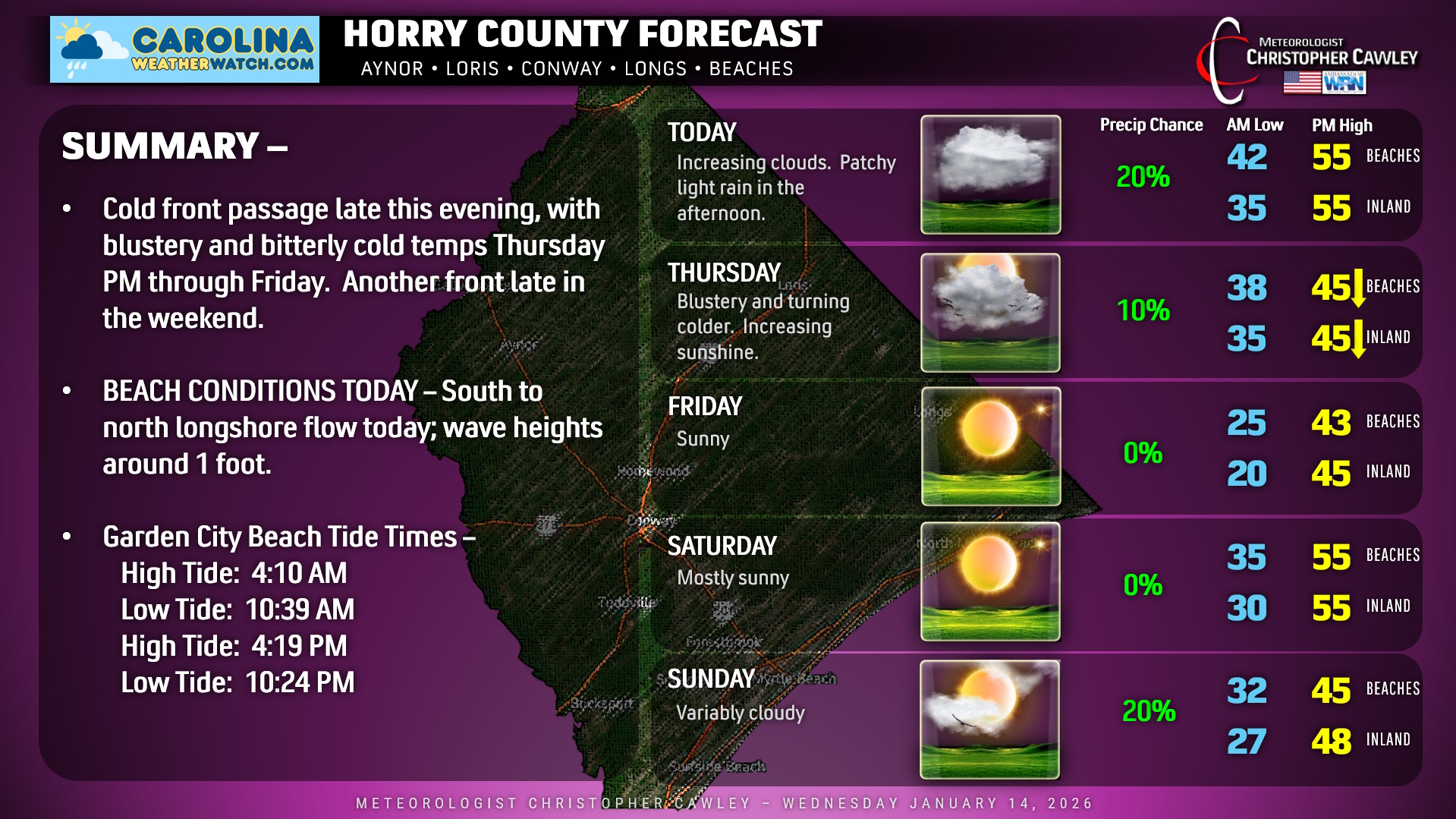
The highlights of your Horry County area forecast include two big-time (but moisture-starved) cold fronts moving through the region. The first one moves through this evening. We may see some patchy areas of light rain this afternoon into the evening, especially along the beaches. Today will feature seasonable highs in the mid to upper 50s.
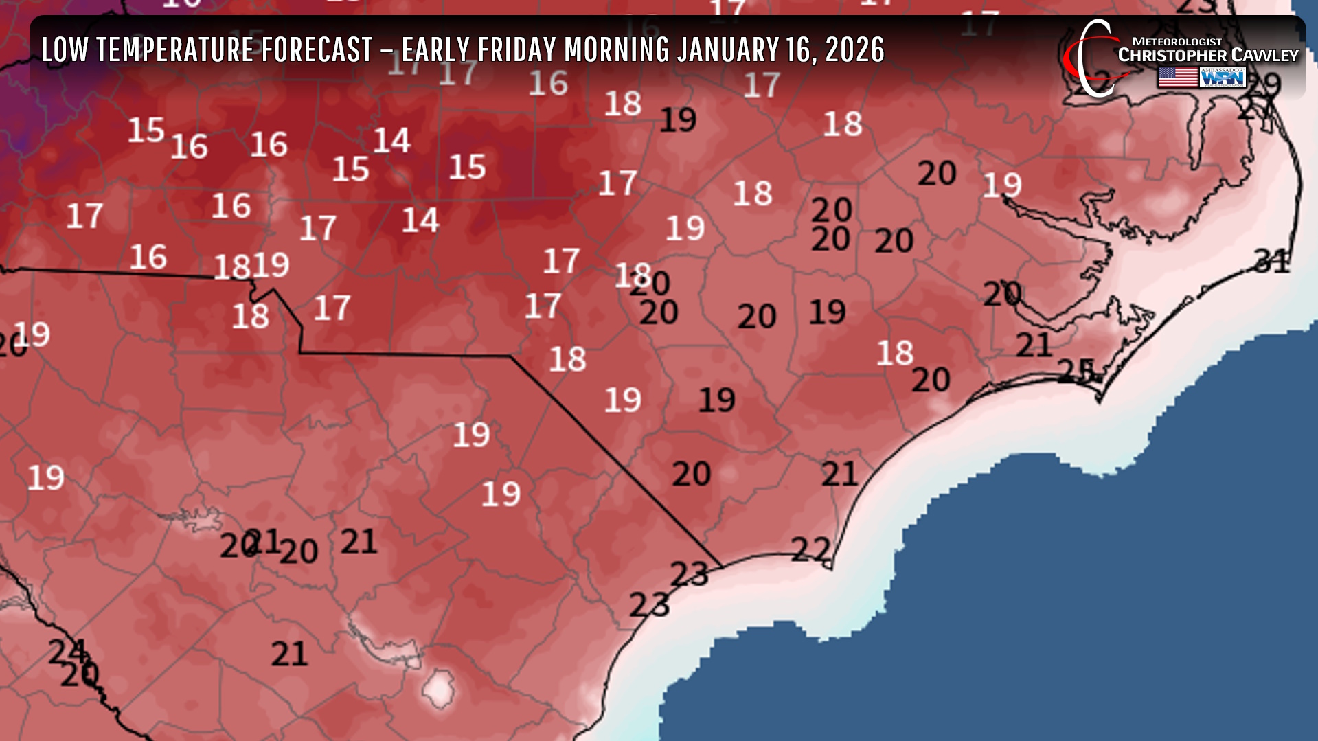
Cold front blows across the area this evening, but the cold air won’t really push in until winds pick up on Thursday. Thursday will feature our highs in the mid 40s, but that will happen before lunchtime. Temps will be falling during the afternoon … and they’ll keep falling until bottoming out around 20 (inland) or the mid 20s (beaches) on Friday morning. Despite full sunshine on Friday, highs will be in the lower to middle 40s (10+ degrees below normal).
We’ll see a brief warm-up back to “normal” for Saturday before the NEXT frontal system moves through late Saturday night.
Some models want to spin up a little low on the front AFTER it crosses the area late Saturday night. This would throw some precipitation — possibly frozen precipitation — into the area on Sunday but I’m not quite ready to jump on board the “snow train” quite yet. Otherwise, dry and cold going into next week.
Here’s your Horry County Area Forecast for today!
–Meteorologist Christopher Cawley
www.CarolinaWeatherWatch.com

Be the first to comment