

")
Greetings and welcome to the weather update for Brunswick County for Tuesday January 6, 2026.
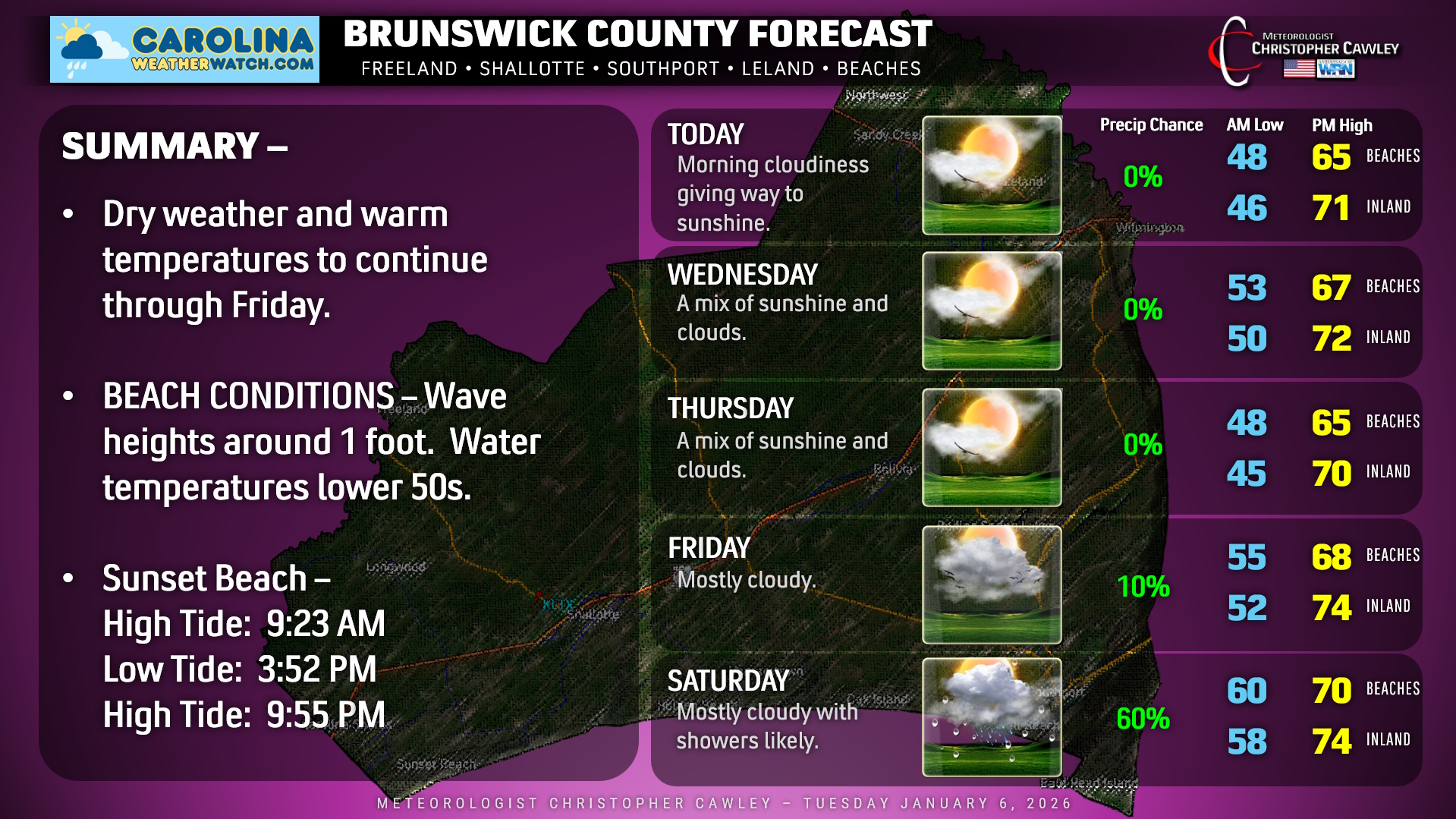
Dry and warm… that’s the theme for the Carolina twin tiers right into the weekend. The overall pattern is one of high pressure, but a little cold front will drop down from the north late Wednesday. This will bring some cloudiness around, and the temperatures on Thursday will be down a degree or two, but otherwise, unseasonable warmth continues unabated.
…..until a rather robust cold front crashes the party Saturday afternoon. A deep southerly push of warm and moist air will take place on Friday, Friday night, and into Saturday ahead of this front. A few showers are possible Friday night but most of the activity (whatever we get) will accompany the front on Saturday. It’s not going to be a lot, but every little bit helps our ongoing drought conditions.
As for the beaches, quiet conditions will continue but the air temperature is going to be several degrees colder thanks to water temps in the lower 50s. That southerly wind flow will be coming right off that colder water so, yeah, the beaches themselves are going to be rather chilly. Wave heights only about 1 foot.
Here’s your Brunswick County area forecast!
–Meteorologist Christopher Cawley
www.CarolinaWeatherWatch.com

Be the first to comment