

")
Welcome to the Carolina Weather Watch Weather Update for Monday January 5, 2026.
Here’s today’s forecast key points:
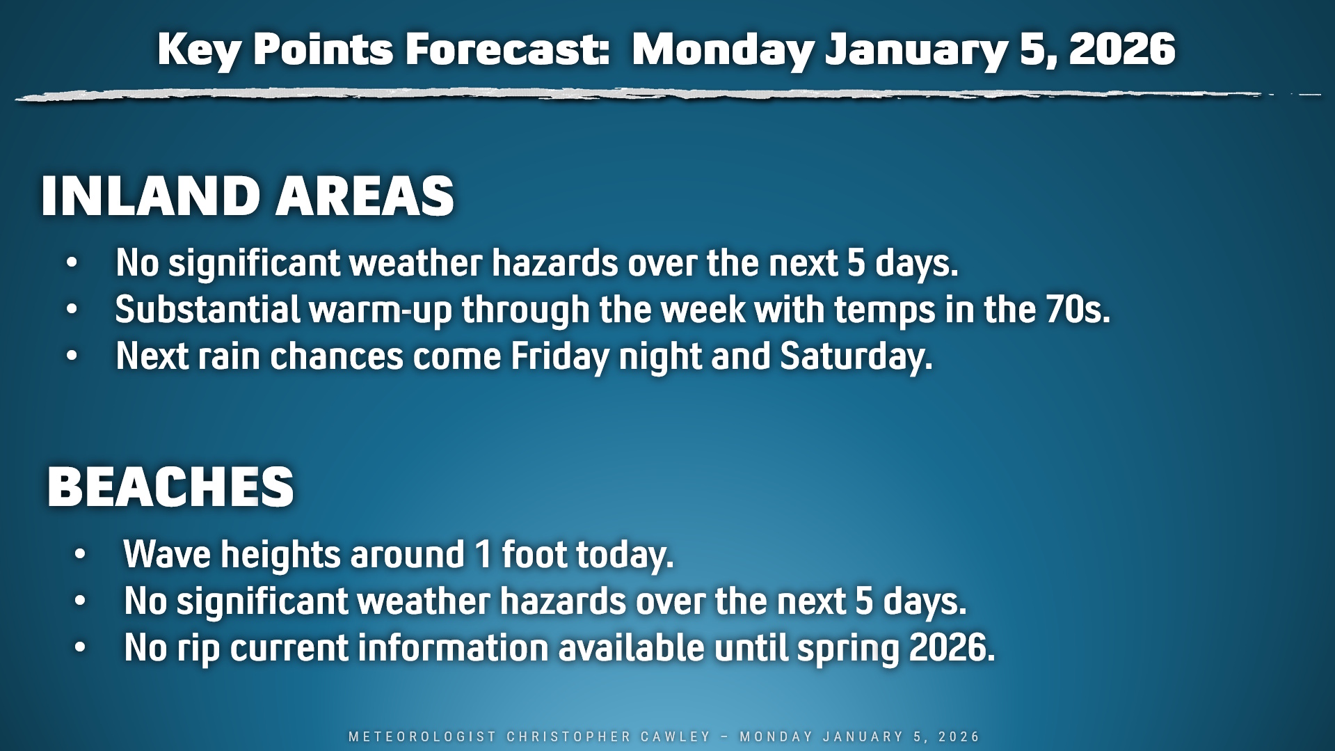
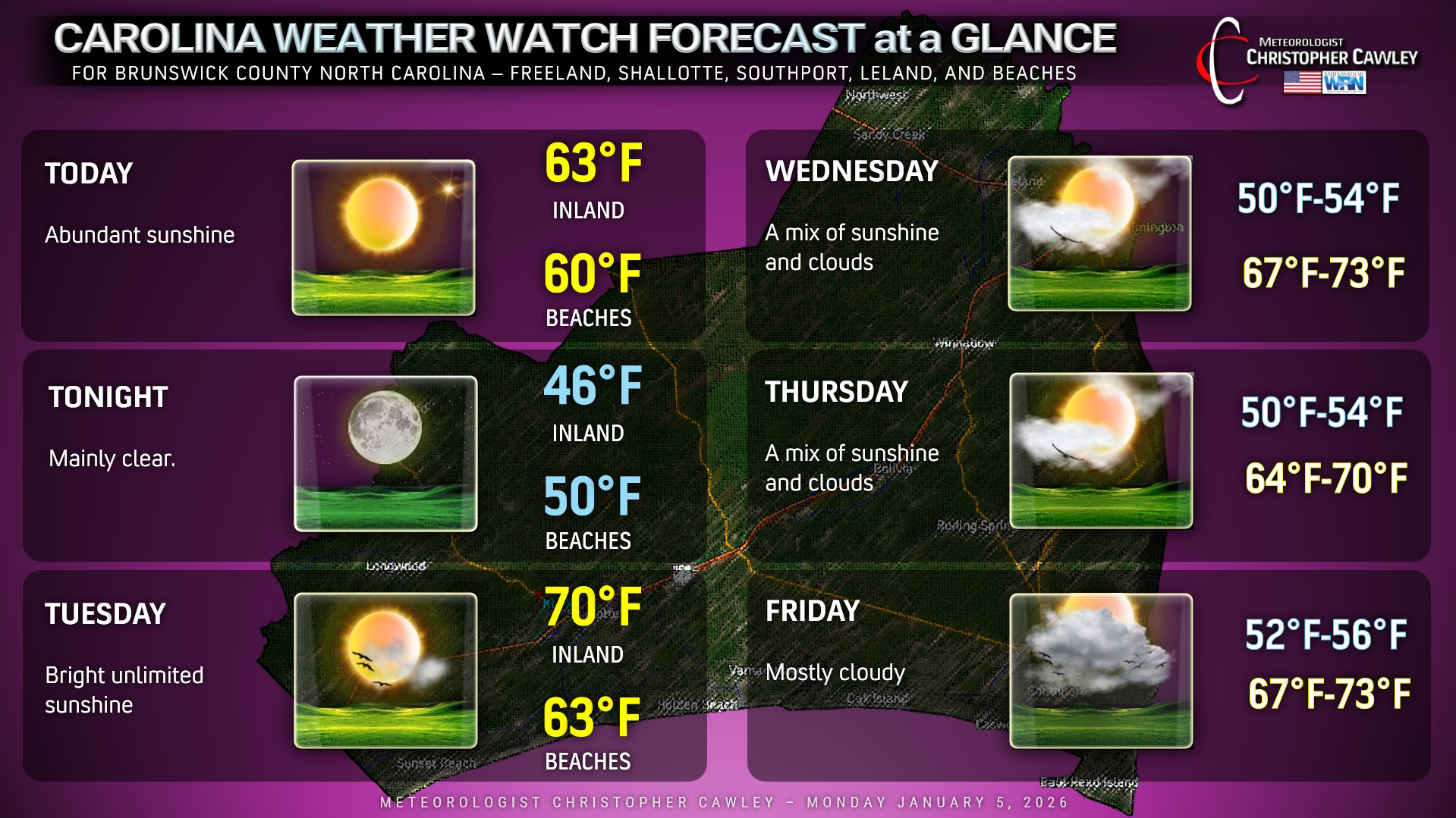
OVERALL: Strong high pressure nearly overhead will shift slightly offshore going into Tuesday. This will allow a southerly push of warm air to move into the coastal Carolinas. Unseasonable warmth will dominate the area as highs jump into the 70s for all areas away from the beaches for both Tuesday and Wednesday. Cooler temps at the beaches thanks to that cold wintertime ocean water.
A weak “backdoor” cold front (if you want to call it that) will drop south over the area late Wednesday afternoon or Wednesday night. This will have very little noticeable impact on our weather; highs on Thursday might be a degree or two cooler than what we have on Wednesday.
The warmth continues on Friday as a renewed southerly push takes place ahead of a rather strong, dynamic cold front. Most of the “interesting weather” with this front goes off to our north but as the front pushes through Saturday afternoon, a few scattered showers are possible… maybe even a rumble of thunder (but that’s up for some debate). Once the front moves through, temperatures return back to reality — closer to seasonal normal values — going into the week of January 12th.
BEACH CONDITIONS: Rip current forecasts will take place starting in the spring when “beach season” begins. The Myrtle Beach Pier 14 sea-water temperature is 51 degrees, as of Sunday evening. According to available records, the water temperature is nearly 18 degrees colder than seasonal normal right now. Sea-surface temperature at Holden Beach is approximately 52 degrees. Wave heights throughout the day today will be around 1 foot.
TIDES:
SUNSET BEACH–
High tide 7:45 AM
Low tide 2:21 PM
High tide 8:11 PM
NORTH MYRTLE BEACH–
High tide 10:44 AM
Low tide 6:02 PM
High tide 11:08 PM
MYRTLE BEACH SPRINGMAID PIER–
High tide 7:47 AM
Low tide 2:25 PM
High tide 8:14 PM
LOCAL AREA FORECASTS FOR BRUNSWICK COUNTY
Thank you for reading, and have a wonderful day!
~ Meteorologist Christopher Cawley

Be the first to comment