

")
Greetings and welcome to the Horry County Weather Update for Friday January 9, 2026!
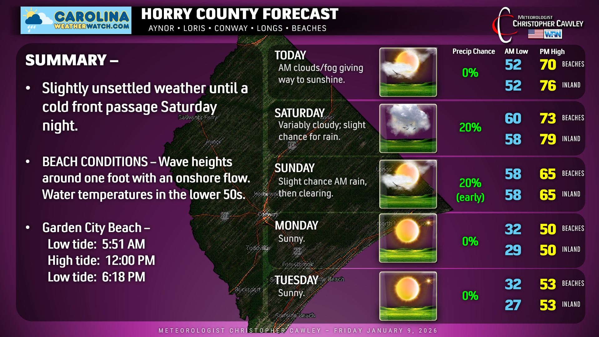
A warm front has lifted north of the area this morning. This will usher in an unseasonably warm and rather humid air mass that will remain in place until a cold front sweeps across the area late Saturday night.
Today will feature considerable cloudiness and some sunshine, after areas of fog burn off this morning. Inland highs will reach the mid and upper 70s, a solid 20 degrees above seasonal normal values, while temperatures at the beaches will top off around 70.
Warm and becoming breezy tonight and Saturday with more cloudiness and some spotty light rain in the onshore flow for your Saturday. Inland highs rise to the upper 70s… possibly flirting with 80 if we can get enough sunshine… with highs in the lower 70s at the beaches.
Cold front moves through Saturday night and this will bring a few scattered showers across the county. Nothing significant, perhaps a tenth of an inch of rainfall or so. A second front will move through Sunday morning with the potential for another rain shower, but then we’ll see increasing sunshine … and decreasing temperatures … Sunday afternoon. Our highs on Sunday will likely occur before lunchtime, with a slow drop during the afternoon.
Temps really tumble Sunday night after the sun goes down, and we’ll be in the upper 20s to around 30 inland on Monday morning… lower to middle 30s at the coast. Despite full sunshine, highs on Monday rise to around 50. Dry and seasonable conditions will continue on Tuesday before our next weather system brings the chance for rain on Wednesday.
BEACHES: Onshore flow means considerable cloudiness along with some patchy light rain through Saturday. Waves will be around one foot.
Here’s your Horry County area weather forecast from Carolina Weather Watch!
–Meteorologist Christopher Cawley
www.CarolinaWeatherWatch.com

Be the first to comment