

")
Greetings and welcome to the Brunswick County Weather Update for Friday January 9, 2026.
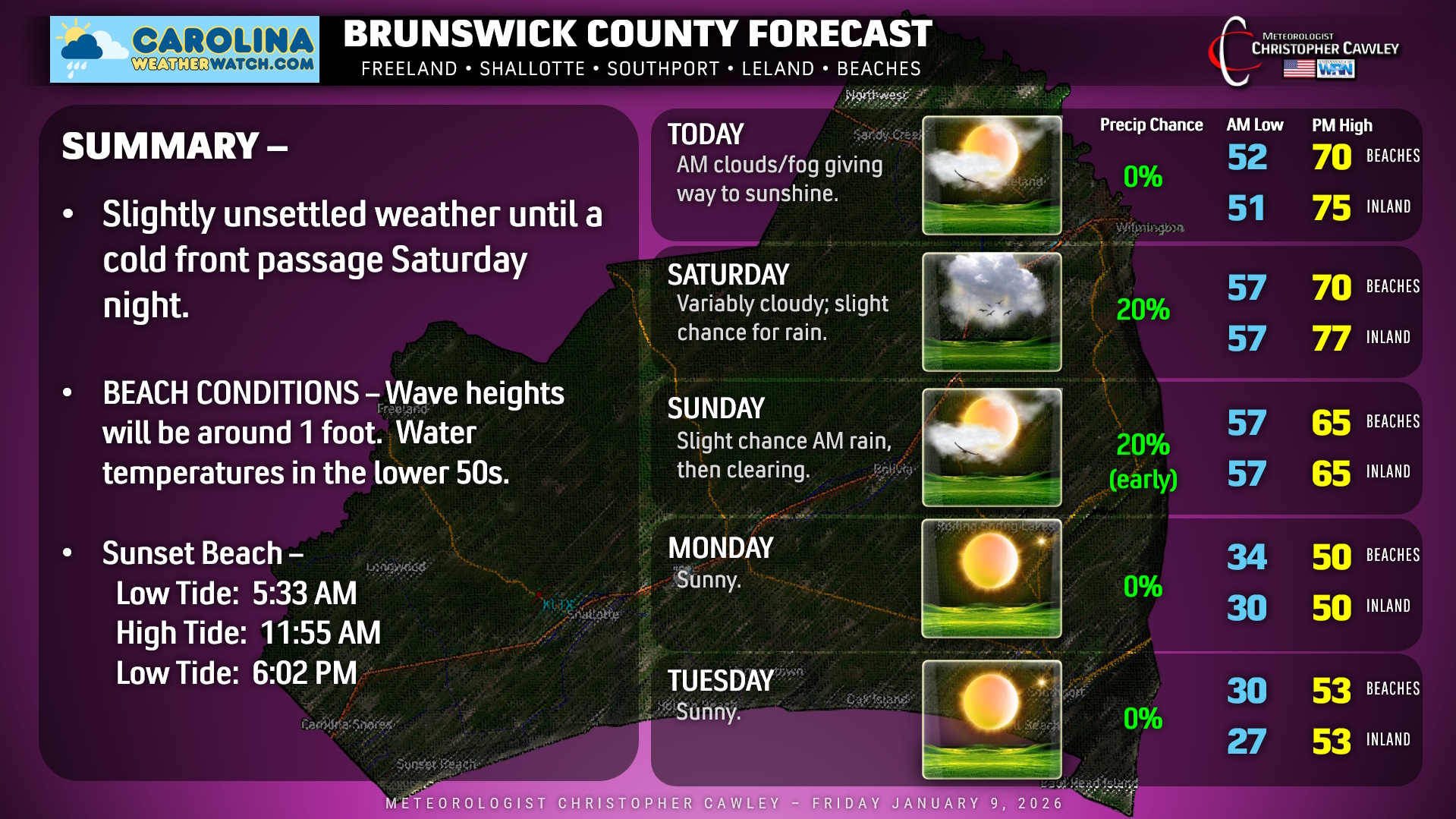
A warm front has lifted north of the area this morning. This will lead to an unseasonably warm and rather humid air mass that will be in place until a cold front moves through late Saturday night. An onshore flow will keep considerable cloudiness across the area and may bring some areas of light rain late tonight and Saturday. Temperatures will be in the middle to upper 70s away from the beaches, a solid 20 degrees above seasonal normal values.
The front moves through with a good chance for some showers along and ahead of it. Rainfall amounts won’t be spectacular, though… perhaps a tenth of an inch of rainfall.
A second cold front blows through during the morning hours on Sunday. This, too, may trigger an isolated rain shower but we’ll see increasing sunshine through the afternoon hours. Our highs on Sunday will likely take place before lunchtime, with temperatures slowly starting to fall during the afternoon hours.
Temps then tumble Sunday night, returning to mid-January reality on Monday. Despite full sunshine, we’ll be lucky to hit 50 degrees. Seasonable temperatures continue on Tuesday with dry weather. Our next system arrives with the chance for some rain on Wednesday, with continued seasonable temps in the mid 50s.
BEACHES: An onshore flow will keep considerable cloudiness at our beaches, and I can’t rule out some patchy light rain today, tonight, and Saturday. Waves will be around 1 foot. No significant adverse weather is expected.
Here’s your Brunswick County area weather forecast!
–Meteorologist Christopher Cawley
www.CarolinaWeatherWatch.com

Be the first to comment