

")
Greetings and welcome to the Columbus County Weather Update for Friday January 9, 2026!
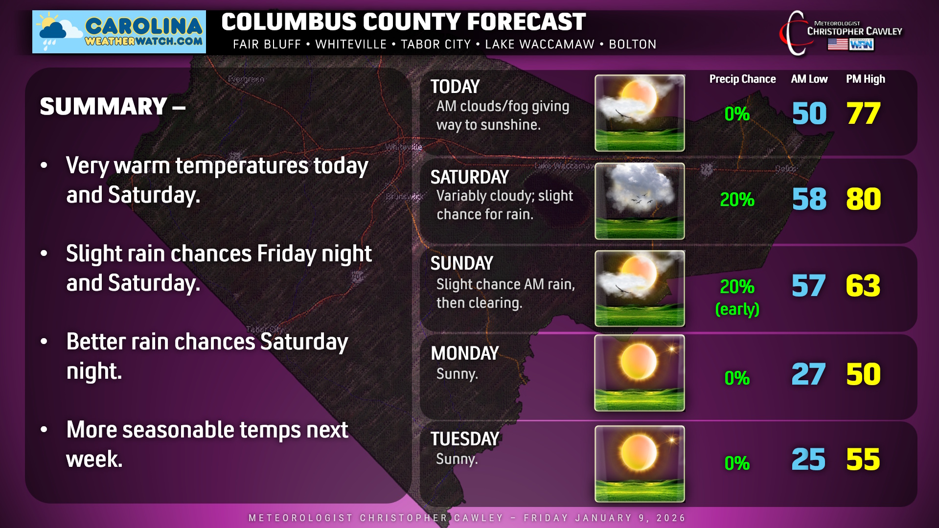
A warm front has lifted to the north this morning. Once the clouds and fog burn off, we’ll have partly to mostly sunny skies today with an unseasonably warm and rather humid air mass in place. This will stay locked in until a cold front moves through Saturday night.
Highs today will reach the middle to upper 70s, which is easily 20 degrees above the seasonal normal values. Tonight will remain quite mild with considerable cloudiness. Some areas of fog will likely develop once again, and some patchy light rain is also possible after midnight, especially over the eastern half of the county.
Saturday will feature near-record warmth with highs flirting with 80, if we can get enough sunshine. Still, the southeasterly flow will bring the potential for some clouds and patchy light rain in the morning hours… with more sunshine in the afternoon.
The cold front then moves through Saturday night, bringing scattered showers along and ahead of the boundary. Not much rain can be expected — perhaps up to a tenth of an inch. A second front moves through Sunday morning with another shower possible, then clearing skies and falling temps likely through the afternoon.
Temps really tumble Sunday night with clear skies, and we’ll wake up to temps in the 20s on Monday morning. Despite full sunshine, highs only rise to around 50 on Monday afternoon. Dry and seasonable conditions are likely on Tuesday before the next rain chances arrive on Wednesday.
Here’s your Columbus County Area Weather Forecast!
–Meteorologist Christopher Cawley
www.CarolinaWeatherWatch.com

Be the first to comment