

")
Greetings and welcome to the Columbus County Weather Update for Thursday January 8, 2026.
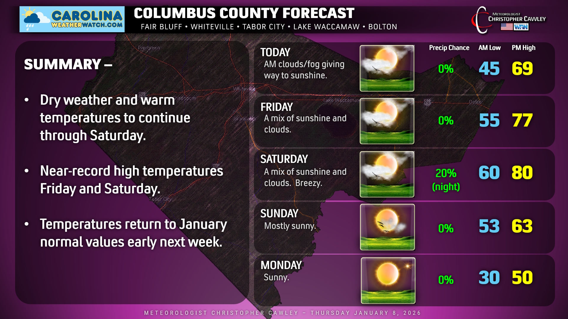
Normal high: mid 50s
Normal low: mid 30s
Keep that in mind as you read today’s blog post.
A weak cold front has dropped just south of the area early this morning. This will lead to temperatures slightly cooler today than they were yesterday. Otherwise the cloudiness and patchy fog this morning should dissipate by mid-morning, and we’ll see considerable sunshine for the remainder of the day. Highs will be right around 70 degrees this afternoon, solidly 15 degrees above seasonal normal values.
The front moves back north as a warm front late tonight. An unseasonably warm and somewhat humid air mass moves into the area for Friday and Saturday, with breezy conditions developing Saturday afternoon. We’ll have considerable cloudiness mixed with sunshine, with temperatures Friday and Saturday will range from the upper 70s on Friday to around 80 on Saturday.
A strong but moisture-starved cold front moves through Saturday night, pushing offshore during the overnight hours. A few spotty rain showers may accompany the front, but any rainfall should be light, amounting to no more than a few hundredths of an inch at most. Sunday’s highs will likely occur in the morning hours as a secondary cold front pushes through around lunchtime. Temps then fall during the afternoon, and really drop off after sunset. Temps early Monday morning will be around 30 degrees at the bus stop. Highs on Monday will struggle to reach 50. Dry weather with seasonable temps will continue into the middle of next week.
Here’s your Columbus County, N.C., forecast chart! Thank you for reading and have a fantastic day!
–Meteorologist Christopher Cawley
www.CarolinaWeatherWatch.com

Be the first to comment